


Everest Challenge Climbs — Lower Rock Creek
Related: Eastern Sierra, Everest Challenge, hard core, peak bagging, Rides, Rock Creek
See the Rock creek details on the Upper Rock Creek page.
From Millpond, Lower Rock Creek entails about 2800' of elevation gain and about 18.5 miles to get to the start of the upper Rock Creek climb at Tom’s Place, with nearly as much elevation gain on the approach as the Rock Creek climb itself
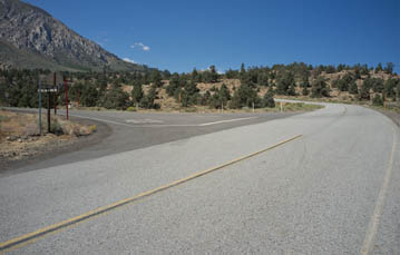
Lower Rock Creek start of NEUTREL ZONE (for 2011)
For 2011, this section of Lower Rock Creek is part of a neutral zone which starts here at Swall Meadows Rd.
Everest Challenge Stage Race
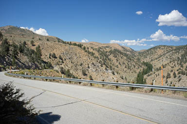
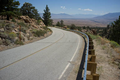
Lower Rock Creek “big dip”
For 2011, this section of Lower Rock Creek is part of a neutral zone. The big dip here is fast and twisty, so pay attention, and do not swing wide in the lanes!
Everest Challenge Stage Race
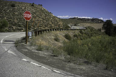
Turning onto Hwy 395
This is the end (at US 395) of the 2011 neutralized zone which started at Swall Meadows Rd.
There is a short section that requires cycling on Hwy 395, but the wide shoulder area makes this reasonably safe in spite of the traffic going 65+ mph.
Shown below is the last bit of Lower Rock Creek. At the stop sign, turn left (carefully!) on to US395, proceeding north to take a left for the Upper Rock Creek climb.
Everest Challenge Stage Race
US395 looking south. Turn left (north) here, but watch for very fast traffic in both directions.
Everest Challenge Stage Race
Returning to Millpond
Looking south towards the Pine Creek area from Lower Rock Creek Rd, just past the “big dip”. Far in the distance is Millpond and the town of Bishop.
There is a lot of elevation gain here, but when returning south to Millpond, you also get this very enjoyable desent, and the return journey is not part of the timed course for 2011.
Everest Challenge Stage Race
