

$220 SAVE $130 = 37.0% Western Digital 16.0TB Western Digital Ultrastar DC HC550 3.5-in… in Storage: Hard Drives
|

$500 SAVE $75 = 13.0% OWC 1.0TB OWC Atlas Pro SDXC V60 UHS-II Memory Card (2-Pack) in All Other Categories
|

|

|
|

|
White Mountain Peak MTB — Lower Half Silver Canyon
Related: gear, hard core, Inyo National Forest, mountain biking, peak bagging, Rides, Silver Canyon, White Mountain Peak, White Mountains
The Silver Canyon portion can be thought of in two halves:
- Lower Silver Canyon from the Owens River to the gate at about mile 7.8.
- Upper Silver Canyon from the gate at mile 7.8 to the flat summit pullout at the top of Silver Canyon.
Most of the 4WD road has very good grip and slippage is not a problem, but the very steepest portions have enough loose material that riding up grades approaching 30% (briefly) can be a challenge without the lowest of gearing and the strongest of legs. There are extended sections in the 20% range in upper Silver Canyon.
Riding is only a slight uphill for the first ~1.5 miles, then begins to steepen as the canyon mouth is entered, at which point grabbing the lowest or near-lowest gear becomes attractive.
Average grade of 13.7%
From the first creek crossing at mile 2.5 to the gate at mile 7.8, grade averages 13.7%, climbing 2670 vertical feet in only 5.3 miles. That is already steep, but it’s not nearly as hard as the upper section!
Entering the canyon
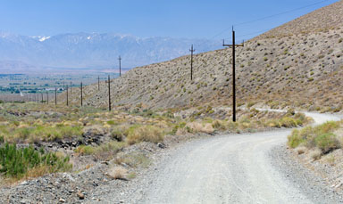
Leaving Laws and traversing about a mile of open area, one enters lower Silver Canyon (as seen below), which is already at a good 10% or better grade. The easiest gear is already useful here if one wishes to maintain a good cadence, but this area is still relatively easy going.
One of the eight water crossings in Silver Canyon. The crossings are deep enough that getting one’s feet wet can be an issue, so pay attention.
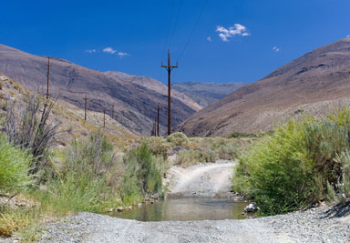
The water crossing can be much fun, but if it’s cold, wet feet are not fun, and could produce blisters if too wet and the sock and shoe fit are not appropriate. But the low humidity dries things out quickly on most days.
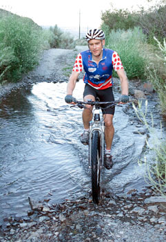
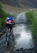
Photo by Geoffrey Faraghan
At mile 5.0, an overhanging cottonwood makes for a pleasant spot for a short stop, or a later picnic when not riding on a schedule. But on the way up, it is advisable not to dally more than a minute or two at such spots, because the time adds up over the day.
As one approaches the gate leading to the steep upper Silver Canyon, the road steepens. If this feels hard, set your expectations, because it soon gets a lot steeper. As shown below. the road hooks a hard left; the gate is found where the road hooks left. This is a good place for a cache of food and water.

About mile 5.5
The gate between lower and upper Silver Canyon is just to the left of where this picture was taken, which shows the last part of lower Silver Canyon.