


$220 SAVE $130 = 37.0% Western Digital 16.0TB Western Digital Ultrastar DC HC550 3.5-in… in Storage: Hard Drives
|

$500 SAVE $75 = 13.0% OWC 1.0TB OWC Atlas Pro SDXC V60 UHS-II Memory Card (2-Pack) in All Other Categories
|

|

|

|

|
White Mountain Peak MTB — Locked Gate to White Mountain Peak Summit
Related: hard core, Inyo National Forest, mountain biking, peak bagging, Rides, White Mountain Peak, White Mountains
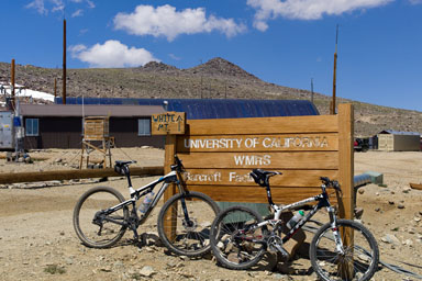
Leaving the locked gate behind at mile ~25.0 / 11,600', a moderately steep climb levels out after about a mile, with the University of California Barcroft research station appearing a few miles later.
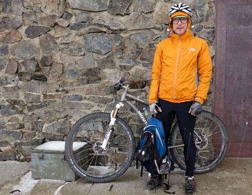
This photo taken the day prior to our full ascent, a test ride.
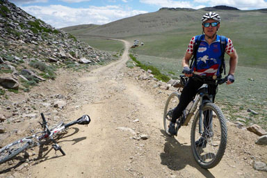
Photo by Geoffrey Faraghan
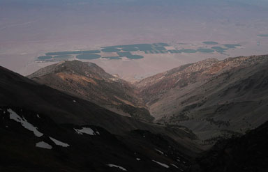
In the image below, one can see the road at center from Patriarch Grove.
This photo taken the day prior to our full ascent, a test ride.
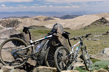
A location we named Gunsight Rock, location of our 4th and final cache, a critical cache for both up and down portions.
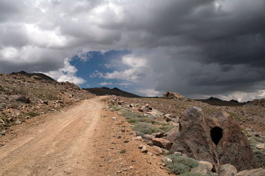
The clouds are now becoming worrisome with audible thunder and visible lightning and rain.
This photo taken the day prior to our full ascent, a test ride.
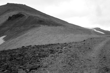
The road visible at far (below) right gets loose and rocky until the low summit left of center, but is rideable most of the way with some effort. Topping out, one can ride all the way to the saddle across the wide and broad meadow, very nice stuff.
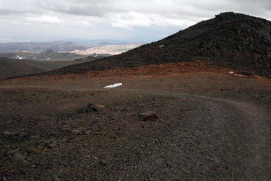
Passing the White Mountain Research Center (formerly known as the University of California Barcroft Facility prior to 2012), the very rough 2-track road turns upward with perhaps a 13-15% grade, much of which is loose fist-size rocks and gravel which is difficult to ride without generating substantial power. However, except for a short middle section, nearly all of this grade is rideable.
This photo taken the day prior to our full ascent, a test ride.
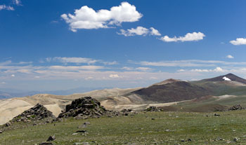
Once one tops out at the minor summit past Barcroft, a broad meadow appears, populated by hordes of marmots and some pika. From here, all is rideable until the top of the small hill abutting the saddle near top center, where conditions become very loose and rocky for 100 feet or so. Otherwise it is entirely rideable up and down.
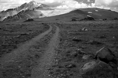
Route dips, then rises to hum at right, descends into saddle, then climbs to summit
Once one crests the short section past Barcroft, a broad meadow opens with a clear view of the summit some miles away. A fast descent into the meadow is follow by a gradually steepening climb to the top of a low hill, which then drops into a saddle via a very loose and rocky section, perhaps the riskiest descent of the entire ride. Since fatigue and altitude are at play, only the most skilled and alert riders should consider the nastiest 100 yards or so of this descent
Once in the low point of the saddle, the route, begins to climb steeply, with good sections of very rideable road, but also with short sections with loose rock and gravel, so one might have to alternately ride and walk. Assuming one has acclimatized and has good power, 80% or more of the 2-track road (barely) can be ridden all the way to the summit, but if snow persists, one will have to bypass the road and tediously climb loose scree/talus to reach the summit, since snow can obscure the last sections of the road just below the summit.
This photo taken the day prior to our full ascent, a test ride.
Most snow had melted by the July 29 2011 ascent, but a few patches remained.
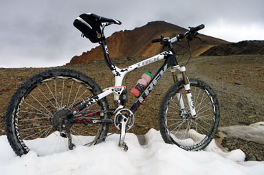
Photo by Geoffrey Faraghan
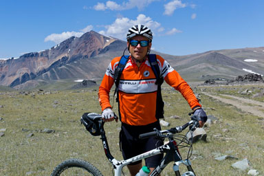
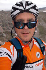
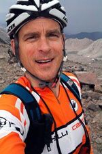
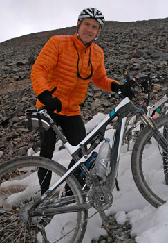
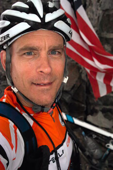
I’m alive and kicking at about 12,800'. No, I don’t have a skin problem, that’s the horrible color banding noise of the Sigma DP2x digital camera.
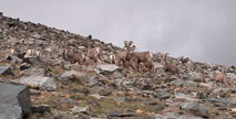
A large flock of Bighorn Sheep can often be seen in this area, or even all the way down to Silver Canyon. This herd is closely monitored and studied, with many of the animals bearing transmitter collars around their necks.
The summit structure finally comes into view. While this section is eminently rideable, as it steepens and turns loose and rocky it becomes more difficult.
At this point I’m in good spirits because it sure looks like I’ll succeed in summitting.
While the weather isn’t so bad to the south, lightning and rain are present to the east. The meadow shown here was later coated with a bright white layer of fresh snow.
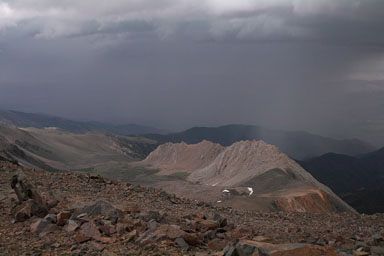
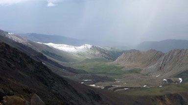
Photo by Geoffrey Faraghan
Looking back towards the University of California Barcroft research station from about 13,700'.
Approaching the summit
On July 29, 2011, snow blocked the road to the summit, forcing a tedious clamber up the loose scree/talus slope, not so difficult on foot perhaps, but a lot of extra trouble pushing a 29er bike uphill.
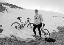
At this point, the heavy cloud cover had dropped the temperature into the 40’s, and so I donned my Mountain Hardware Nitrous down vest and my IbexWear full-finger gloves, as well as my Pearl Izumi tights. Lightning and snow and hail were visible to the east.
Deep and very soft snow blocked the road, which mean a tedious and very slow scramble pushing the bike up loose scree/talus.
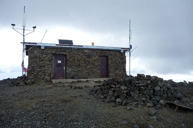
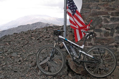
Lightning rods snake away from the building, do not spend time here when the air is crackling!
Photo by Geoffrey Faraghan
2012
See the 2012 photos.